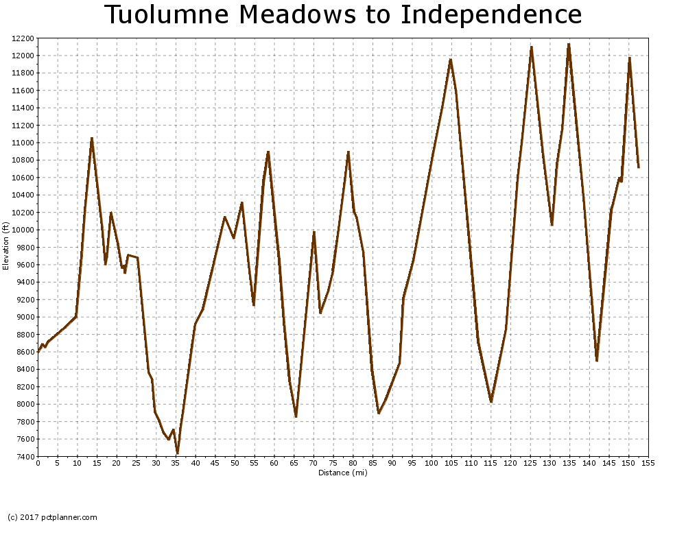
PCT SoBo - CA Section H - Tuolumne Meadows to Kearsarge Pass

I was excited to get back on the Yosemite. To the south lied what many hikers say is their favorite part of the PCT. When I was going North in 2017, almost every hiker said the John Muir Trail section of the Sierras was their favorite, hands down. It's also the hardest. It includes a dozen or so mountain passes, thousands of feet of elevation gain, and the highest point on the entire PCT.
Donahue Pass
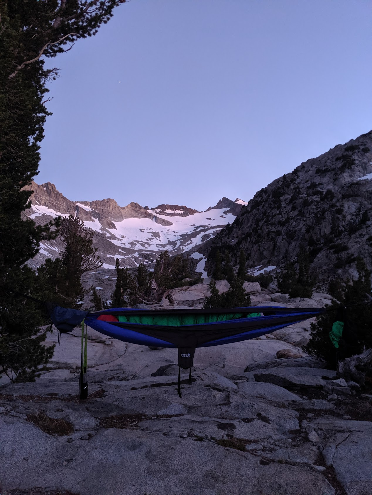
After a restful zero day, I was ready to hit the trail in Tuolumne meadows. I was impressed by the part of Yosemite Wilderness I went through in the last section and there was still a day left of it south of Tioga Pass. The PCT follows the Tuolumne river till it hits the mountains surrounding Donahue Pass. I spent the first night up in the pass, just before the trail leaves Yosemite and enters the Ansel Adams Wilderness.
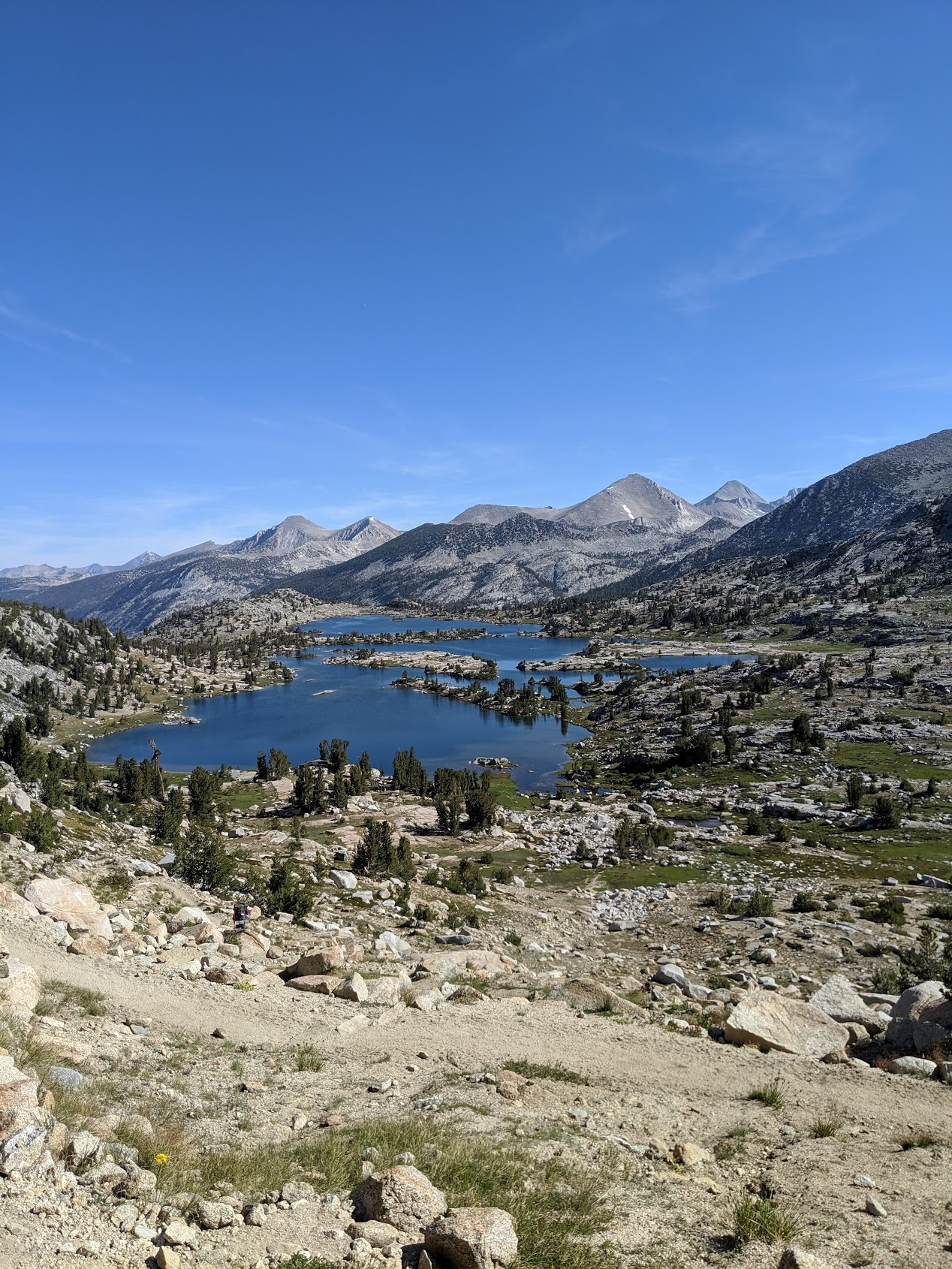
Island Pass
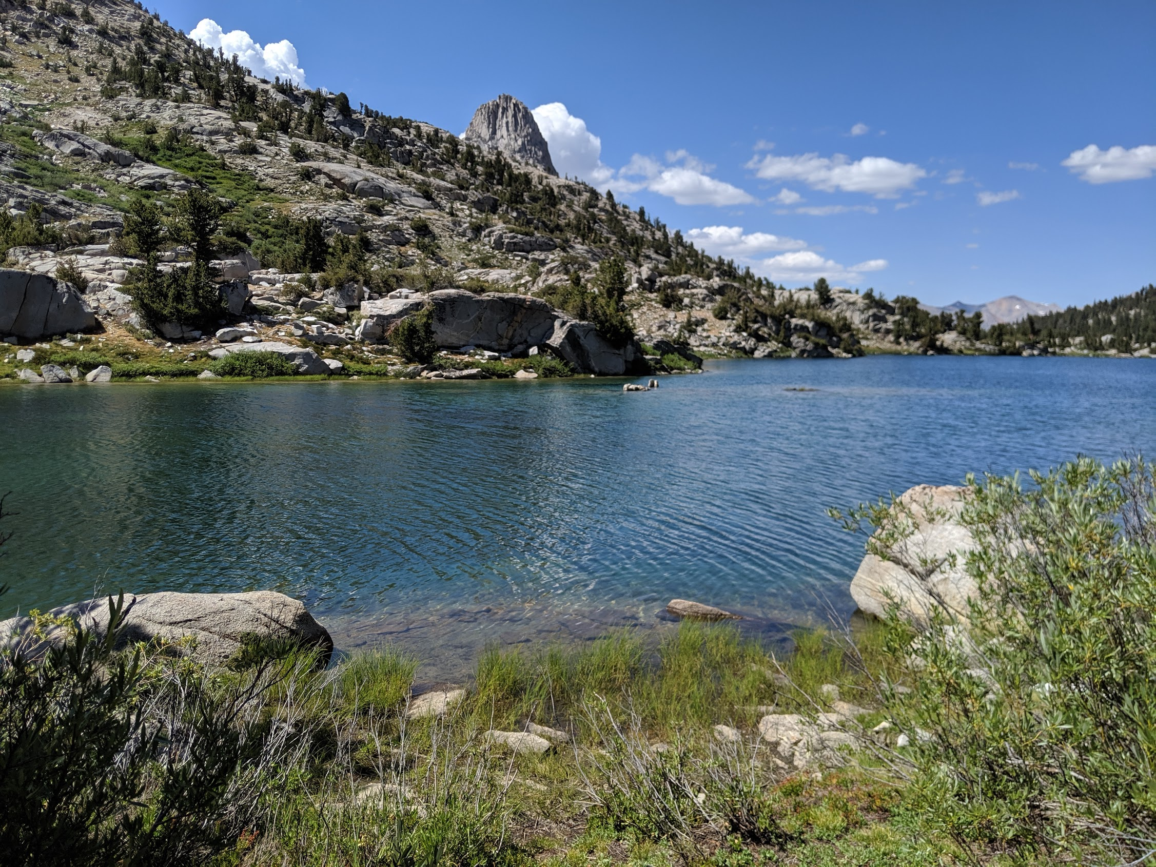
The majority of the next day was up above the treeline. The entire area is exposed granite carved by glaciers in the last ice age, creating dramatic and stunning mountains. By the afternoon, I had crossed over Island Pass and dropped into the basin that contained Thousand Island Lake. With its crystal clear water and the powerful Mt. Davis in the background, it was easily one of the most beautiful lakes I have seen on the JMT. I ended up basking in the sun by its shores for an hour longer than I had originally planned.
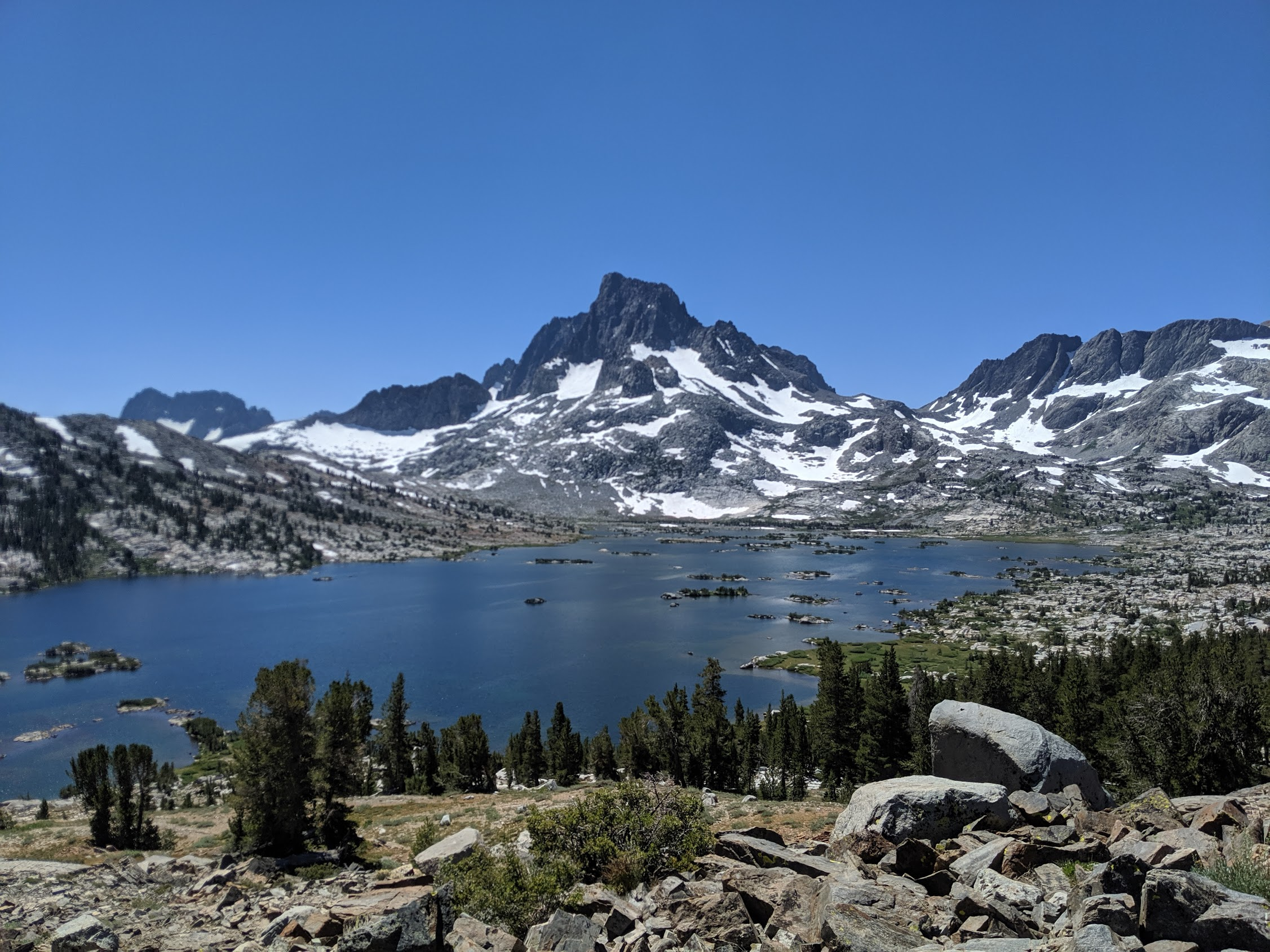
Here, the PCT and the JMT split for about 10 miles. The JMT sticks alongside the interior of the mountains whereas the PCT goes along the ridge to the Mammoth Lake area. Despite the prodigious number of mosquitoes, the beauty of Thousand Island Lake convinced me to take the more watery route.
Silver Pass
On the way down to Mammoth and Reds Meadow, I passed by Garnet Lake, Shadow Lake, and Rosalie Lake. The trail quickly descends into the valley with Devil's Postpile. I stopped by the ample hiker box at the campground and resupplied the food I ate in the past couple of days. I ate a hamburger and milkshake at the cafe at the resort, took a shower, and headed back onto the trail to camp underneath the stars.
I started to recognize a few familiar faces that I had passed and said hello to a few times before. The most popular route of the JMT is southbound and it turns out many of them started the same time I had left Yosemite. It was nice to be able to walk alongside and have conversations with some fellow hikers for a change. I had passed a lot of hikers heading northbound before this sections where you really only have time to say hello.
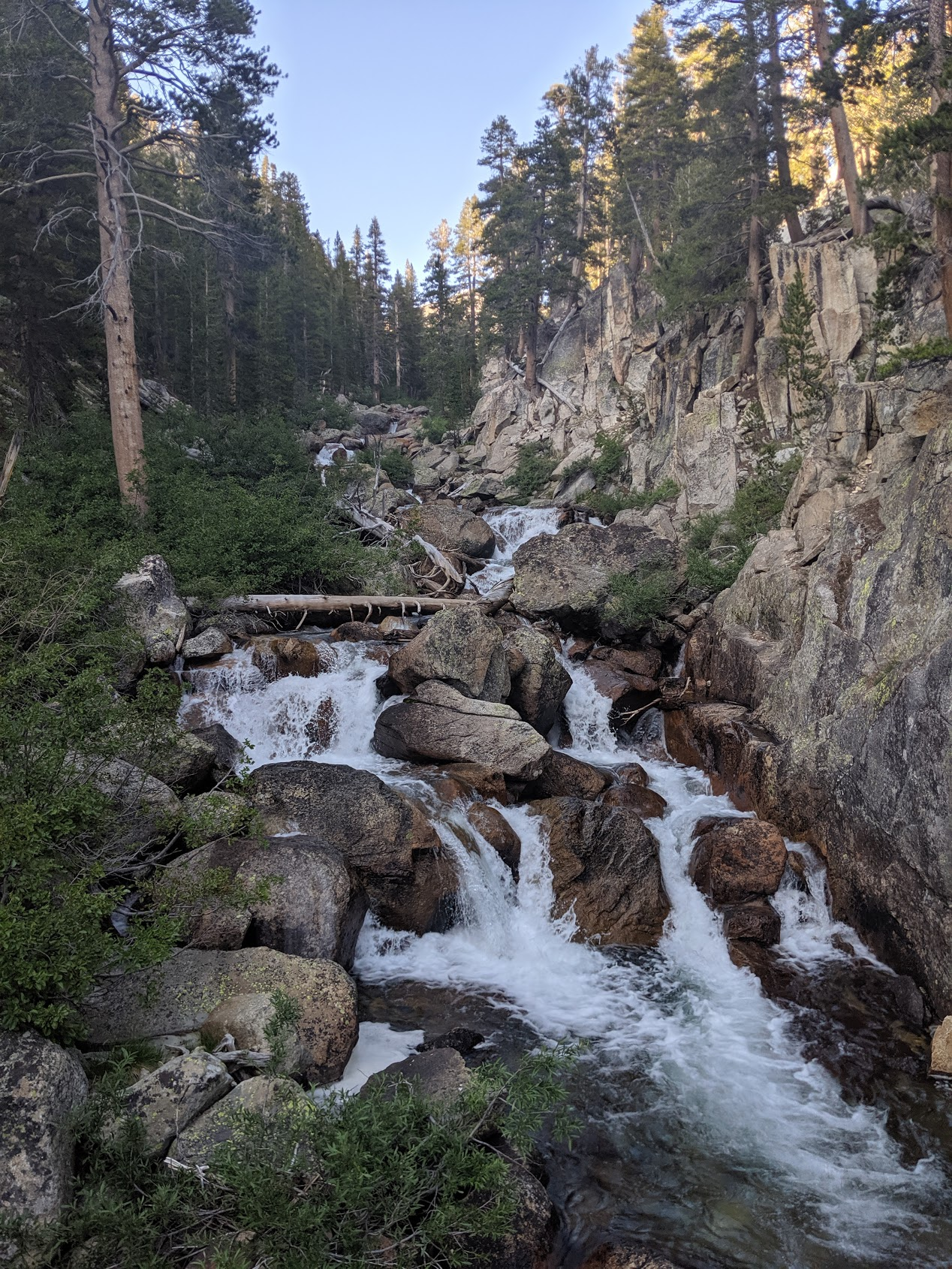
After a night of heavy mosquitoes next to Fish Creek in Tully Hole, I ascended up into Silver Pass. By the afternoon, I was descending on the other side and heading to Edison Lake to take ferry to my next resupply stop.
Seldon Pass
I made the 4:30 pm ferry across the lake to spend the night at Vermilion Valley Resort. The first beer is on the house and the burgers and sandwiches at their cafe hit the spot. I got to acquaint myself with other JMT hikers around the fire at night and fill up my bear canister with more supplies at the hiker box.
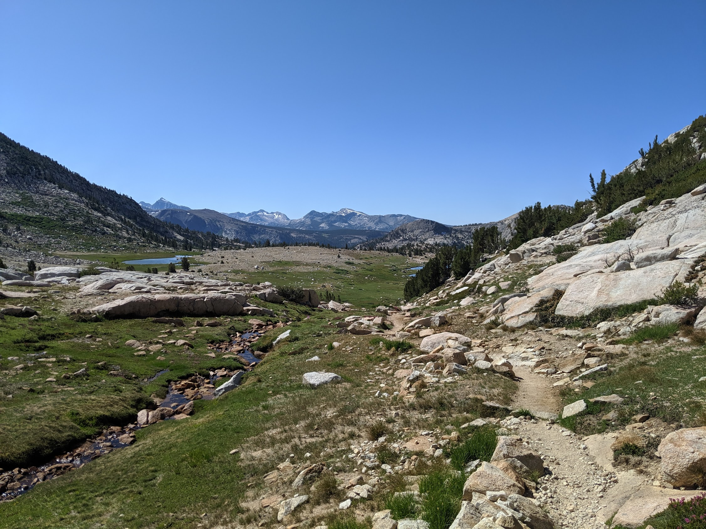
The next morning, I headed back to the ferry and was back on the trail. After a well graded by strenuous climb out of the canyon Edison Lake is in, I was on my way to tackle the 11k ft Seldon Pass. From here on the passes were more constant. Often I was climbing 3000 ft to 5000 ft a day from here on out, tackling a pass or two each day.
After Seldon Pass, the trail quickly descends into the valley with Muir Trail Ranch. It was completely booked out for all of 2019 so I hadn't planned on staying there. I still stopped by for what was rumored to be the best hiker box on the whole PCT. The whole area was drier than any part of the trail so I was thankful for the dip in the headwaters of the San Joaquin river.
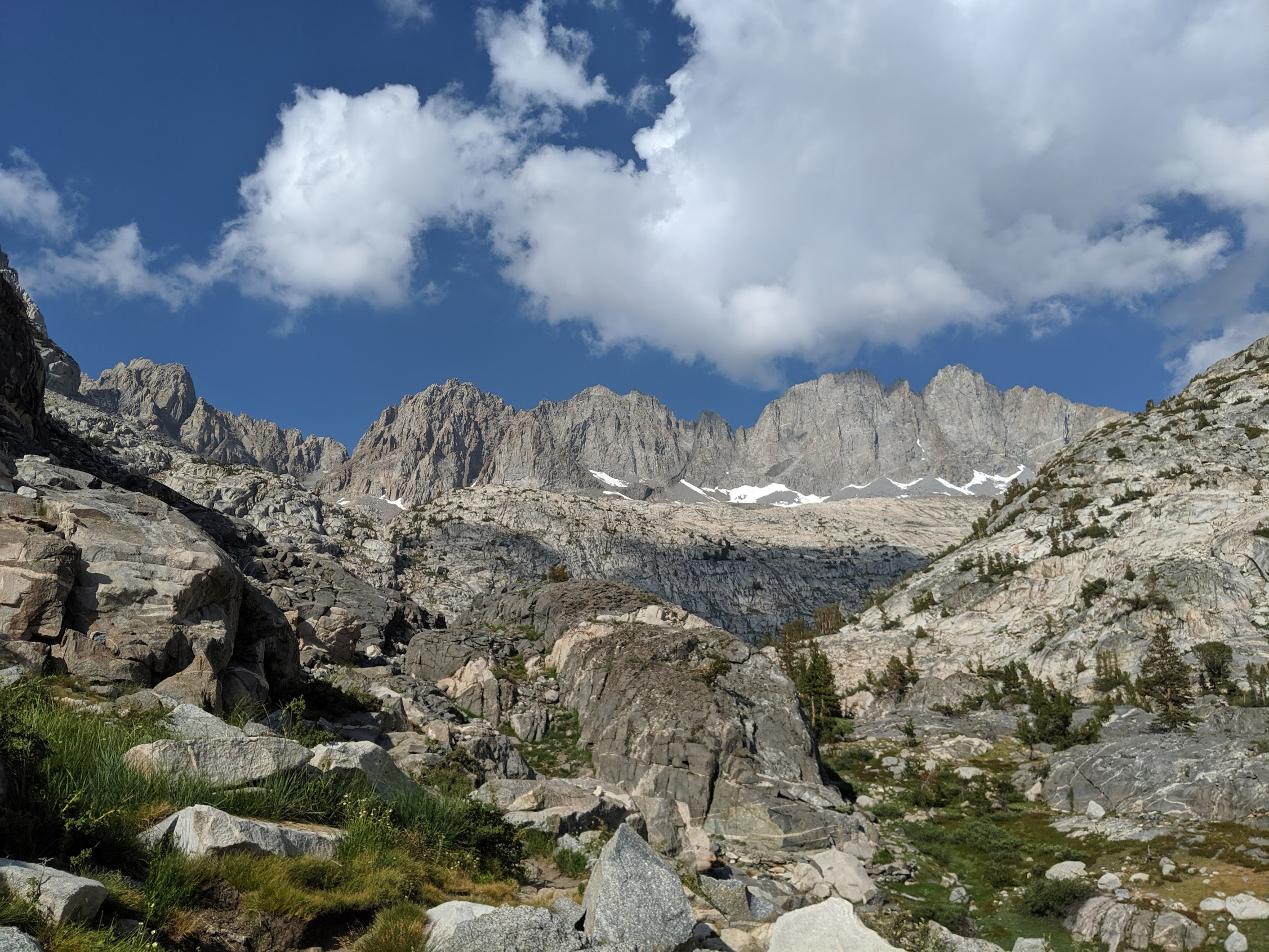
Muir Pass
On the other side of the river, I entered Kings Canyon National Park. I immediately appreciated the deep river canyon and spent a night beside a creek before heading up into the high country. The next morning I entered Evolution Valley, another highlight of the trip.
I followed along the shore of the stunning lakes all the way up to Muir Pass so I could get back below the tree line on the other side. It was a hard day but worth it to reach the spot I camped at.
Mather Pass
As I crossed Muir Pass, I entered the Kings River drainage. Often times this water never even reaches the sea, being used completely used by agriculture in the Central Valley. From up here, the water seemed limitless.
One of the hardest stretches lay above the valley. The Golden Staircase as it is called was the last section of the JMT completed, simply because of how difficulty in tackling the mountain engineering problems. Once you reach the summit, you are surround by the Palisades, a section of the Sierra Nevada mountains with some serious character.
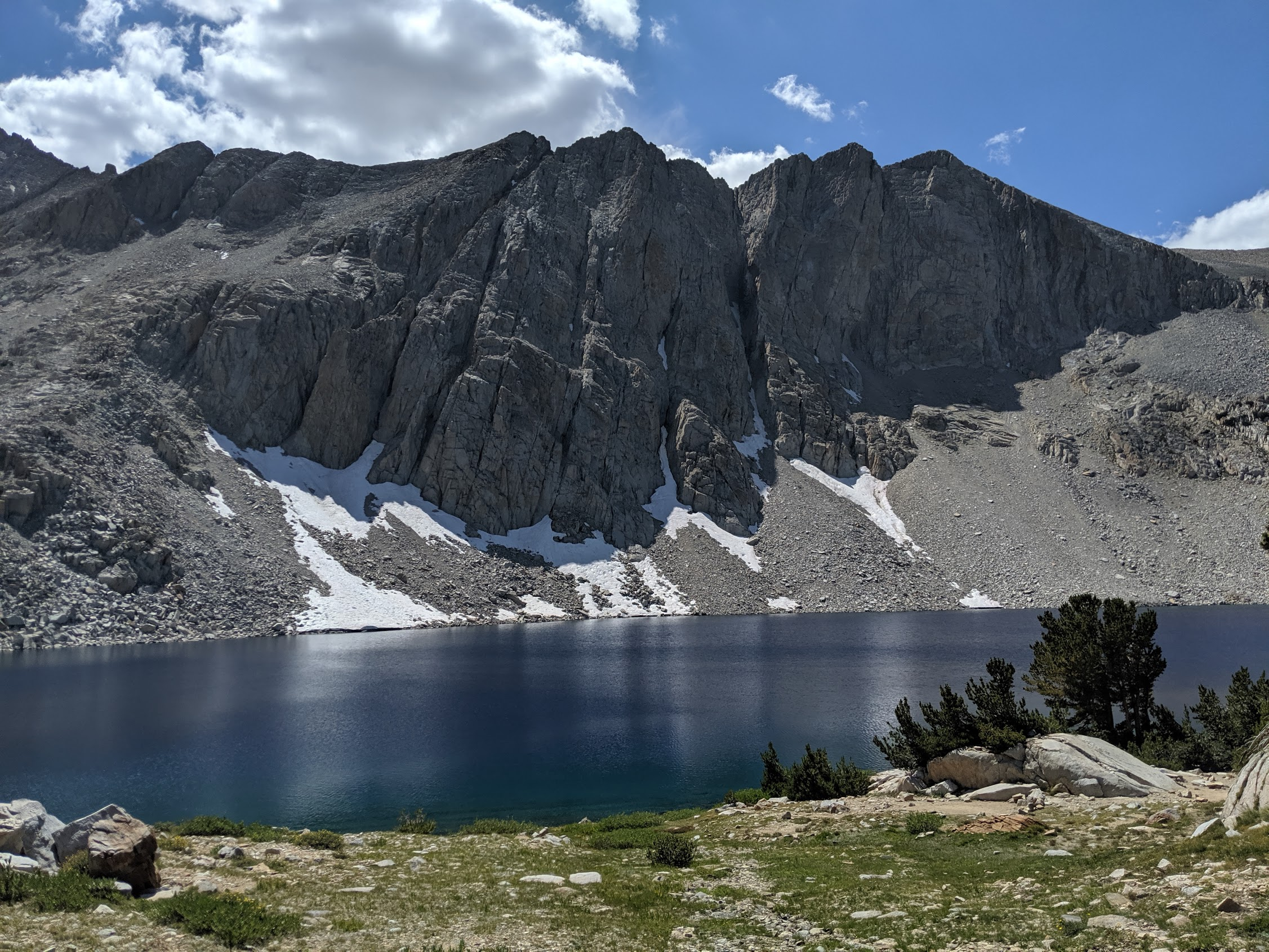
Pinchot Pass
From Mather Pass, I descended into the valley with the headwaters of the South Fork Kings River in it. Desert gave way to lush meadows the further down the valley I traveled into it. Evidence of heavy glaciation is everywhere, whether it it be the large basins for the alpine lakes or generous amount of boulders and moraines that sprinkle the landscape.
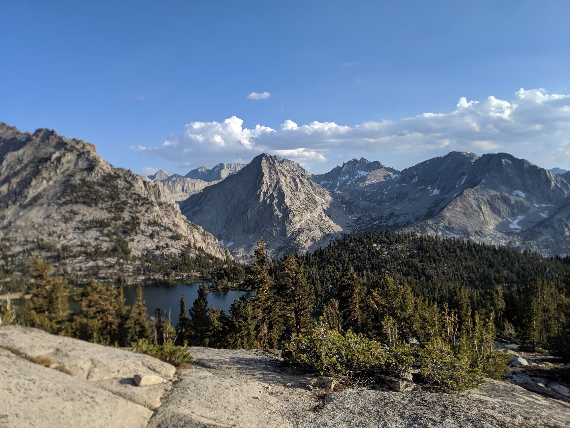
As I approached Pinchot Pass, I came across my favorite lake so far, Marjorie Lake. The deep shade of blue and the imposing mountains that surround it create a scene of beauty that is unparalleled.
Glen Pass
It seemed as though as I got closer and closer to Mt. Whitney, passive kept on getting more and more steep. I slept alongside a full Woods Creek before beginning a long ascent up to Glen Pass. In between Woods Creek and the pass was the stupendous Rae lakes. As I was following the trail along a natural causeway between upper and middle Rae lakes, I stopped for an hour to fish for trout using the hobo reel I carved from Aspen. The lake was absolutely teaming with beautiful rainbow trout. I was able to catch a few and threw them all back.
From the lakes, the trail seems to go straight up the mountain. It was by far the steepest one yet but not too difficult because it was fairly short. From there it is a short downhill journey to Kearsarge Pass and the town of Independence.
The Sierras have met all of my expectations and exceeded them. Every time I've driven down highway 395, I've always appreciated the beauty of these mountains. From climbing Mt. Whitney, I was able to get a peek into the vast wilderness nestled between the high peaks. This is truly some of the most spectacular country in the entire nation and the whole world.