PCT SoBo Section C - Cajon Pass to Cabazon
The most surprising thing I noticed when I entered San Bernadino National Forest was the Mojave River. Since leaving the Sierras, I had only passed a creek and here was an actual river. The trail wound up and down the desert canyon that held the river. I had stocked up my pack with enough water at the pass that I did not need to go down and refill.

About half way through the day, I came across the Deep Creek Hot Springs. Being from northern Nevada, I knew how rare these places are. I slipped in for a quick dip. The water was clear and the perfect temperature. It was a Saturday. Many locals had made the 8 mile or so hike in to enjoy it. I moved on and followed the creek further up the canyon til reaching a picnic area with a gazebo. It sheltered me from the wind. It was getting close to October and the nights were getting longer and colder.

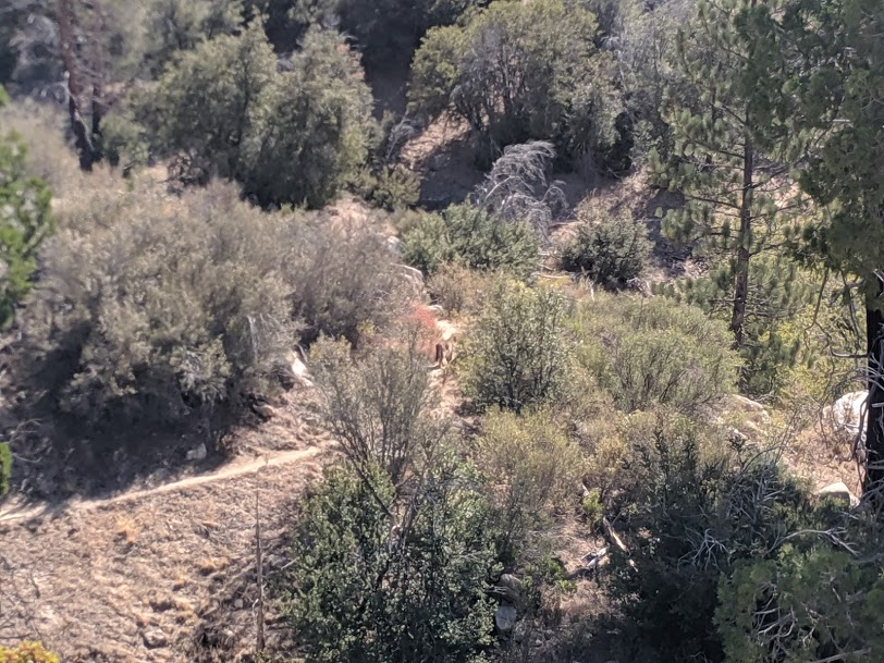
After climbing some more couple thousand feet, I began to reflect on the landscape. I much prefer San Bernardino National Forest to Angeles. It felt like I was back in the wilderness. The terrain was rougher. The roads were much less frequent. I saw no one else after the hot springs. On my second day, I saw my first cougar while hiking. I spotted him further on down the trail before he had a chance to see me. He was only 50 yards or so away. I immediately stopped and waited for him to move on. He moseyed on down into the brush and off trail. I found another way around. As much I as valued seeing this elusive creature, I did not want to be sprung upon by such a large predator.
Soon enough, I found myself approaching the community of Big Bear. I spotted the lake on my third morning and began an unnecessarily arduous trip down the mountainside to the road. It's not the first time I've underestimated how steep terrain is on my maps. I debated whether to spend the night in a hotel there but ended up just resupplying at the local Vons and chilling for a few hours in the nearby Starbucks. A bus brought me back to the trail around sundown and I continued my trek.
The weather for the past few days had been chilly. It had started to reach down into the 20s and my water was freezing at night. I almost exclusively used my tent instead of my hammock. The extra protection that it provides from the wind and the fact I can put on clothes before I get up helps those chilly mornings go that much easier.
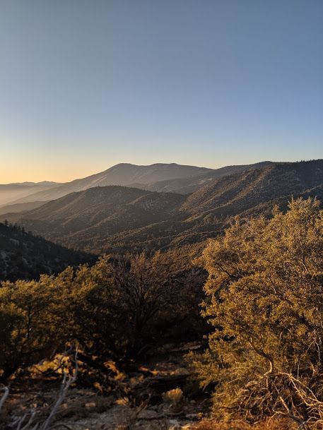
The next part of the landscape I noticed was the large mountain on the horizon, San Gorgonio. The trail passed through a highway and a few forest roads and before I knew it, I was near the trail at the summit. Another cold night at 9000 ft and I would be back among the cactus and sand of the desert. After a stunning sunrise viewed from on high between pine trees, I began the descent to the Coachella Valley.

I enjoyed the forests around San Gorgonio immensely. I'd like to go back in winter when there are several feet of snow around them. It'd be a tough hike as my descent down was over 7000 ft to the valley floor. San Gorgonio is the headwaters of Mission Creek and the Whitewater River. They were both running strong even in early October, before any rain or snow had fallen. The trail followed alongside them in the canyons the rivers had carved out for almost the entire length. After a long day, I crossed the Whitewater River in the dark and set up camp in the dark desert.

The next morning, I was alerted by a sign that the final 10 miles or so of the trail had been damaged by flash flooding earlier in the year. This redirected me to the Whitewater Preserve, a private wildlife and nature reservation. Fortunately, there was a paved road that lead all the way to the freeway from there. The entire time I approached the freeway, Mt. San Jacinto loomed in the distance. I'm looking forward to the long climb up out of the valley and onto the tallest peak in Southern California. From there on out to Mexico, I won't get above 6,000 ft. I won't mind the smooth sailing.


